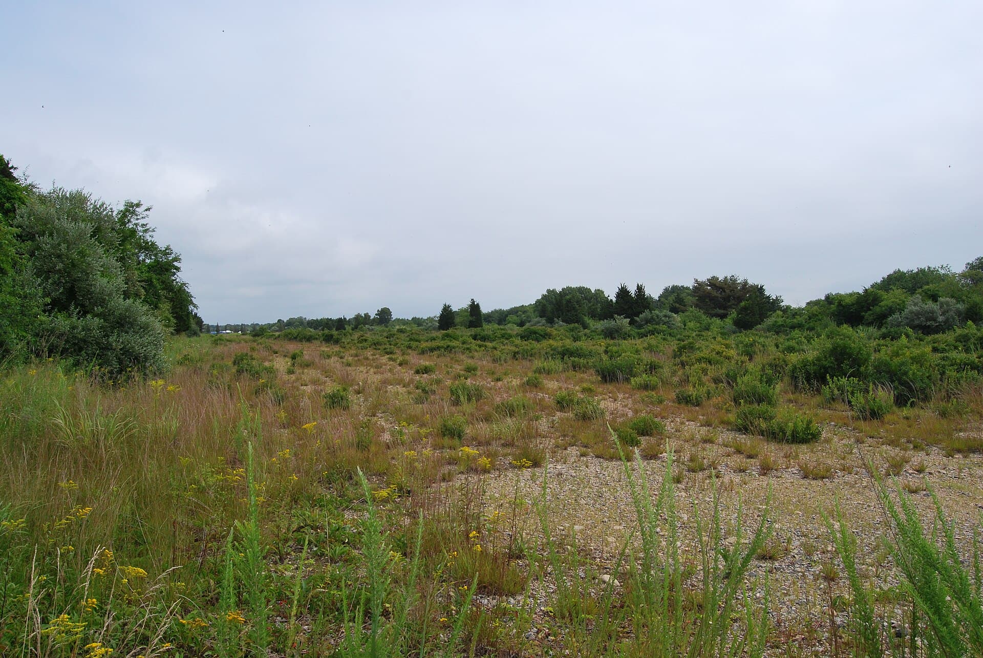
Cracked pavement cuts through coastal vegetation where Navy pilots once practiced for landings at sea.
Ninigret’s forgotten airfield in Charlestown, Rhode Island, survives within a landscape now used for conservation and recreation. Historically known as Charlestown Naval Auxiliary Landing Field, it trained military aviators before its closure in the early 1970s. Parts of the former property became Ninigret Park and Ninigret National Wildlife Refuge.
Visitors looking for a deserted base full of buildings may be surprised. Much of the story is now written in pavement, open ground, interpretation, and the habitat that replaced an airfield.
What was Ninigret’s forgotten airfield?
The Navy acquired the roughly 630-acre installation between 1940 and 1942. During World War II, it trained pilots and flight crews. Later, it supported nearby Quonset Point Naval Air Station.
The Army Corps of Engineers’ site history uses the formal Charlestown name and explains the transfer of the property after military use ended.
That name is worth knowing when searching archives. Ninigret is associated with the modern park and refuge, while historical military records commonly identify Charlestown.
The different names refer to overlapping chapters of one landscape. They should not be taken as evidence of two unrelated naval bases.
Pilots prepared for a moving runway
A carrier landing asks a pilot to bring an aircraft onto a limited surface at sea. Training on land offered a place to develop the necessary skills before facing that challenge aboard ship.
A U.S. Fish and Wildlife Service brochure identifies simulated aircraft-carrier landings as an important part of Charlestown’s wartime purpose.
That connection changes the meaning of the remaining pavement. The airfield was not simply a place where planes arrived and departed. It was part of the preparation that sent crews into a much larger naval war.
The brochure also describes the site’s later habitat restoration. Former runway surfaces covered ground with its own ecological history, including wetlands that biologists identified beneath the military alterations.
Closure happened in stages
The airfield closed in the early 1970s, but its transition to civilian uses cannot be reduced to a single handover.
The wildlife refuge was established in 1970. An initial transfer of Navy land helped begin that process, while a larger transfer to the town and the Fish and Wildlife Service followed in 1981.
These dates describe different steps. A refuge’s establishment does not mean the entire former naval property changed ownership on that same day.
The result was a landscape with separate managers and purposes. Municipal recreation and federal wildlife conservation share the former airfield’s wider footprint, but they operate under different rules.
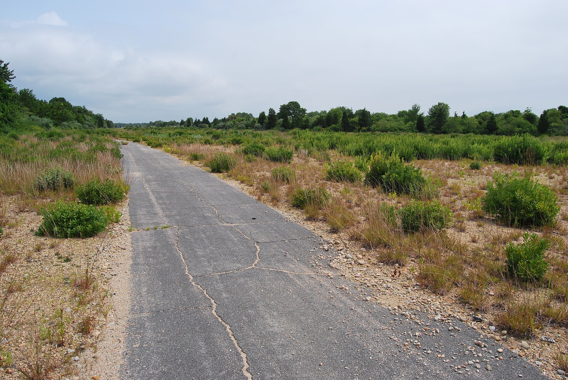
What the photographs reveal
The two photographs accompanying this article were taken in 2010. They show stretches of old pavement and open ground surrounded by vegetation.
There are no dramatic collapsed towers in these views. Instead, the straight surfaces and cracks provide quiet clues to the site’s engineered past.
That subtlety is part of Ninigret’s appeal. A visitor can follow a public path through a landscape that appears increasingly natural while noticing traces of an earlier, highly organized use.
The photographs document a particular moment in the transition. They should not be treated as a promise that every visible path remains open or looks exactly the same today.
A refuge with more than one landscape
The Fish and Wildlife Service’s current overview describes 858 acres of upland and wetland habitats and more than four miles of trails. More than 250 bird species have been recorded at the refuge.
The Salt Pond Unit connects most directly with the former airfield story. The Kettle Pond forested uplands, acquired in 2001, form a different part of the refuge.
That distinction helps with planning. A visit to the Kettle Pond Visitor Center is not automatically a walk across the old naval field.
Views toward Ninigret Pond add another layer to the experience. The water, vegetation, and birdlife make the site valuable for reasons that now extend well beyond military history.
The military legacy includes ongoing investigation
Reusing a defense property involves more than removing buildings. The Army Corps continues to investigate environmental conditions associated with former Navy operations.
Its project records address possible chemical contamination and military material, including work around former disposal and service areas. Public meetings and updates are available through the restoration project’s news page.
This work does not mean all public trails are closed. It means visitors should follow designated access and current notices rather than wandering into work areas or disturbing objects.
A park can be welcoming while parts of its environmental history still require investigation. Both facts belong in an honest account of the place.
Check access before your walk
The official refuge page carries temporary closures and seasonal guidance. As checked on November 3, 2026, it announced a Salt Pond Unit closure for November 14–15 during a veterans’ deer hunt.
Conditions and hunting-related guidance differ by unit and date. Check the latest notice rather than relying on a general description of year-round trails.
Bring binoculars if you enjoy birds, and use interpretive signs to connect the military remains with the longer history of the land. Leave old materials where they are.
Ninigret’s strongest image is a simple one: pavement giving way to living habitat. The airfield’s purpose ended, but the land’s story continued.
Frequently asked questions
What was the naval airfield called?
Official records identify it as Charlestown Naval Auxiliary Landing Field. Its former grounds now include Ninigret Park and refuge land.
Are runways still visible?
Remnants of the old paved surfaces remain within the broader landscape, although restoration has changed much of the former field.
Is the refuge entirely an old airfield?
No. Ninigret includes separate units, including the Kettle Pond forested uplands acquired later.
Can visitors walk anywhere?
No. Stay on designated routes and observe closures, habitat protections, hunting notices, and environmental investigation boundaries.
Image credits
Featured image: Juliancolton, Public domain. Body image: Juliancolton, Public domain.

