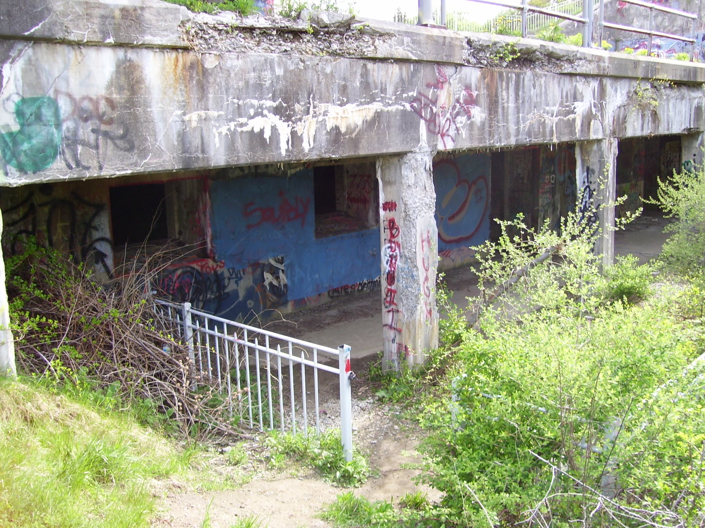
Concrete gun emplacements sit above a coast that now draws picnickers, walkers, and divers.
Fort Wetherill State Park is in Jamestown, Rhode Island, on Conanicut Island. Its surviving coastal defenses overlook the approaches to Narragansett Bay. The military role faded after World War II, and the state acquired the property in 1972.
Today, the park combines historic remains with outdoor recreation. Public park access does not mean every tunnel, ledge, or waterfront structure is safe or open. A worthwhile visit follows designated areas and treats the old batteries as protected history rather than a playground.
How Fort Wetherill defended the bay
Rhode Island’s official fort history places modern construction in the late nineteenth century, as the United States updated its coastal defenses.
The site became Fort Wetherill in 1900, named for Captain Alexander M. Wetherill, who died at the Battle of San Juan Hill. Its seven batteries received their major guns in the early twentieth century.
The position offered height above the water and a view over an important harbor approach. Concrete protection, gun emplacements, and carefully chosen lines of sight made the terrain part of the defense.
During World War II, the installation expanded again, with barracks and supporting activity. The postwar period brought reduced use, and the military eventually declared the property surplus.
That sequence explains the remains more clearly than a sudden-abandonment story. The site lost its mission as military needs changed.
Before the concrete came Fort Dumpling
The name Fort Dumpling belongs to an earlier chapter on the same headland.
The Cultural Landscape Foundation describes the stone fort built in 1798 and its removal during the later expansion of coastal defenses. The modern works did not simply appear on unused land; they replaced and reshaped an older military landscape.
The foundation also draws attention to the relationship among roads, terrain, and vegetation. These features helped organize the installation and conceal elements of it.
A surprising landscape-design connection
The National Park Service’s Fort Wetherill account connects the site with the Olmsted Brothers firm during World War II.
The work involved the arrangement of military facilities and the surrounding landscape. That connection may surprise visitors who associate the Olmsted name only with grand public parks.
Military planning also required decisions about circulation, building placement, and how a developed site would sit within its terrain. At a coastal post, those choices had practical consequences.
This does not mean the batteries were designed as scenic ruins. Their present appearance results from changing use, weathering, and the passage of time. The original purpose was functional, even where the setting is beautiful.
What the state park offers now
The Rhode Island State Parks page describes a 61.5-acre park with opportunities for walking, picnicking, fishing, boating, and scuba diving.
The cliffside setting is central to its appeal. Visitors can combine an interest in the old defenses with time outdoors, without needing access to restricted or enclosed spaces.
Use the current park information to plan facilities and seasonal needs. Do not assume restrooms, group arrangements, or other services operate identically throughout the year.
If diving is part of your visit, make a separate plan appropriate to your training, equipment, and local conditions. The presence of a diving area does not make every part of the shoreline suitable for entry.
For most first-time visitors, a walk through designated public areas is enough to appreciate the contrast between heavy concrete and open water.
Check specific closures before exploring
A June 2024 Rhode Island environmental department notice closed the historic bulkhead behind the Marine Fisheries facility until further notice.
The department cited deterioration and storm-related damage, including sinkholes. It also explained that other parts of the park remained available.
This is an example of why a broad statement such as “the park is open” cannot answer every access question. A visitor may be welcome on one route while a nearby waterfront structure is closed.
Check current notices and obey barriers at the site. Do not use an older photograph, online map, or someone else’s visit as evidence that a particular area has reopened.
Look beyond the graffiti
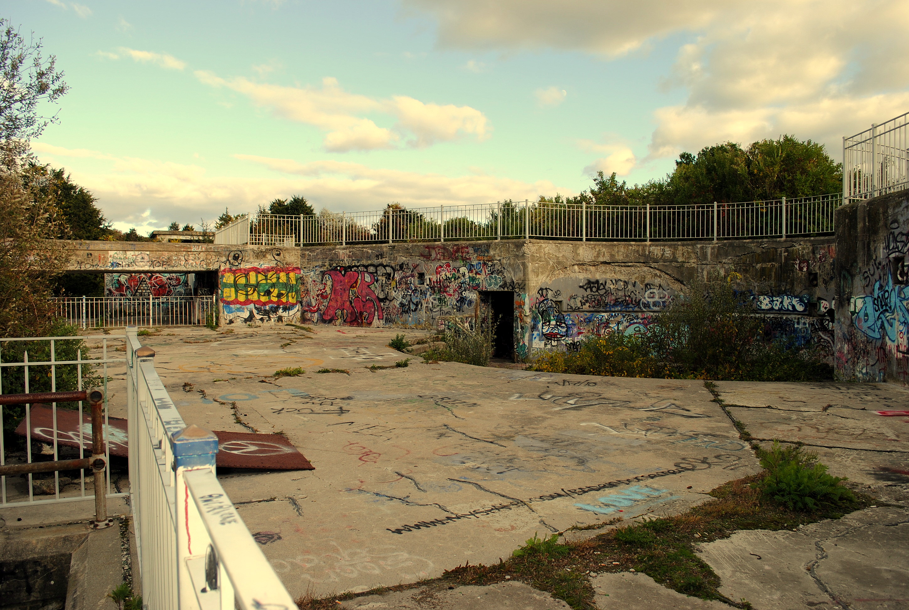
The featured photograph was uploaded in 2008, and the body image was taken in October 2010. Both show graffiti and weathered concrete. They document earlier appearances, rather than guaranteeing today’s conditions.
Look past the surface color to the structure itself. Notice the thickness of walls, changes in level, and the relationship between sheltered spaces and open platforms.
Those details help explain what the fort was built to do. They also make a visit more rewarding than simply collecting another photograph of an empty room.
Leave surfaces and objects as you find them. The strongest memory of Fort Wetherill is the meeting of two scales: massive defenses built for national security and a small coastal landscape now used for ordinary leisure.
Frequently asked questions
Where is Fort Wetherill?
It is in Jamestown on Conanicut Island, Rhode Island, overlooking Narragansett Bay’s approaches.
Is Fort Wetherill a public park?
Yes. Rhode Island manages it as a state park, with specific rules and closures for individual areas.
Can you enter every bunker or tunnel?
No. Public park access does not authorize entry into closed structures or unsafe areas. Follow current signs and barriers.
Is the historic bulkhead open?
A state notice closed it in 2024 until further notice. Check the latest park and environmental department updates before planning access.
Image credits
Featured image: Swampyank at English Wikipedia, CC BY-SA 3.0. Body image: JMPelletier, CC BY-SA 3.0. Images retain their original framing; dates are identified in their captions or the article.

