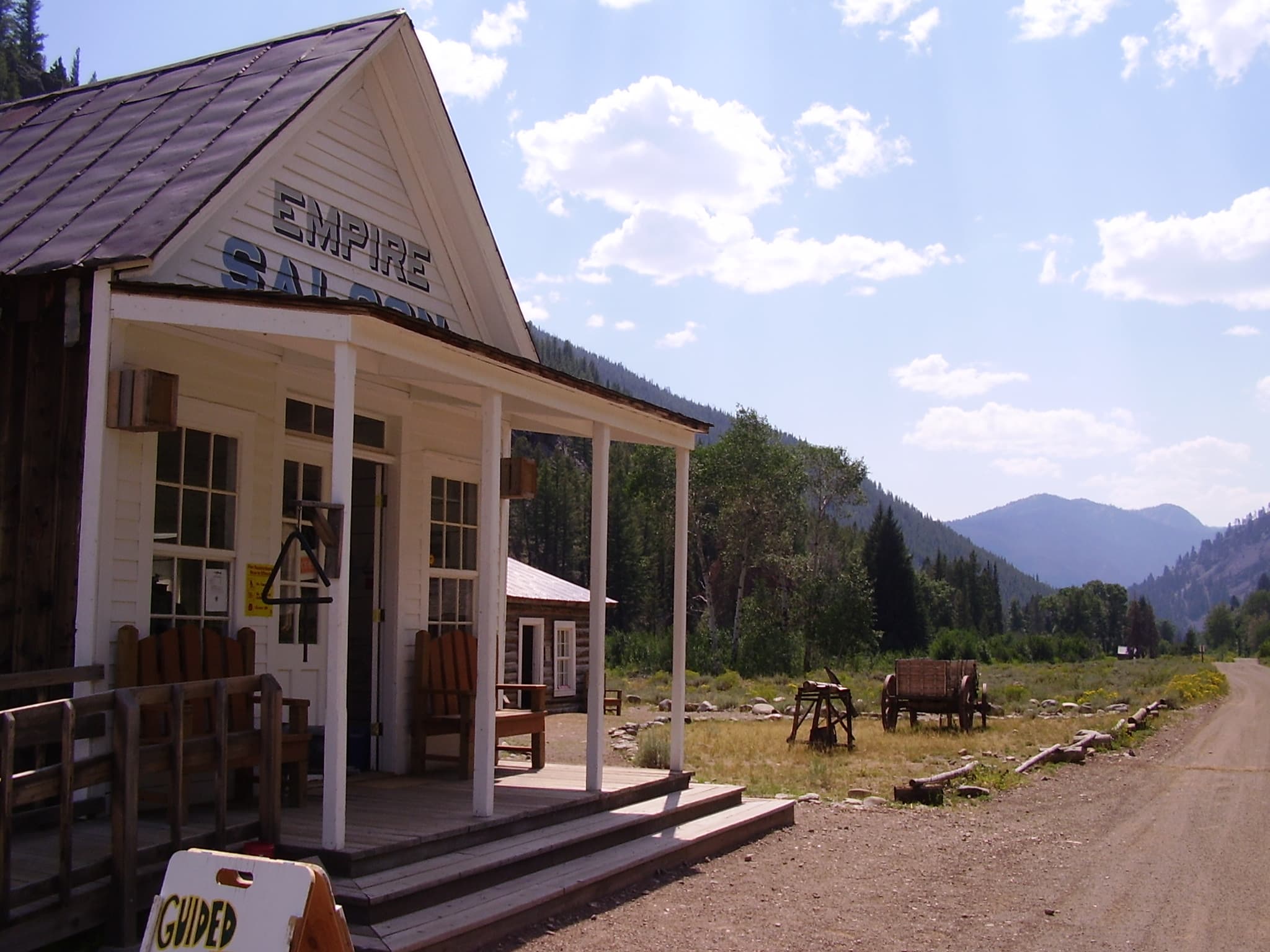
A schoolhouse and a saloon preserve two sides of life in a mountain town built around ore.
Custer ghost town in central Idaho is a preserved mining settlement in the Yankee Fork region, northeast of Stanley. Founded in 1879, it grew to support nearby mines, then faded as their fortunes declined. Visitors can explore its historic setting and seasonal interpretation as part of the broader Land of the Yankee Fork experience. Visit Idaho’s Custer guide
The remaining buildings are only a fraction of the old town. Their value lies in helping you understand the larger community that once occupied this narrow mountain landscape.
How Custer ghost town took shape
The townsite’s preparation began before its formal founding. Its National Register nomination describes forested ground being cleared in 1878 and the cut timber later used for buildings and the General Custer Mill.
Construction accelerated around the mill’s arrival about 1880. Tents, log cabins, and frame buildings served a growing population. Roof designs reflected winter conditions, with steep roofs on many frame buildings helping shed snow. Custer Historic District nomination
That is a useful detail to notice on a visit. The architecture was shaped by weather and available materials, not simply by a shared frontier style.
Visit Idaho identifies the Lucky Boy and Black mines among the operations the town supported. It places Custer’s peak population at about 600 in 1896. The number was modest beside a modern city, but it represented a substantial community in this remote setting.
More than miners and machinery
A productive mine could support a much wider network of work. Custer’s historic inventory lists stores, restaurants, boarding houses, repair trades, a hotel, saloons, and a miners’ union hall.
The town also had a Chinese community at its southern end, with businesses and a place of worship. That record makes clear that Custer’s population was more varied than a simple picture of lone prospectors suggests.
The schoolhouse and Empire Saloon are especially helpful landmarks because they point to different parts of everyday life. Children needed education. Adults needed places to meet, exchange news, and spend time away from work.
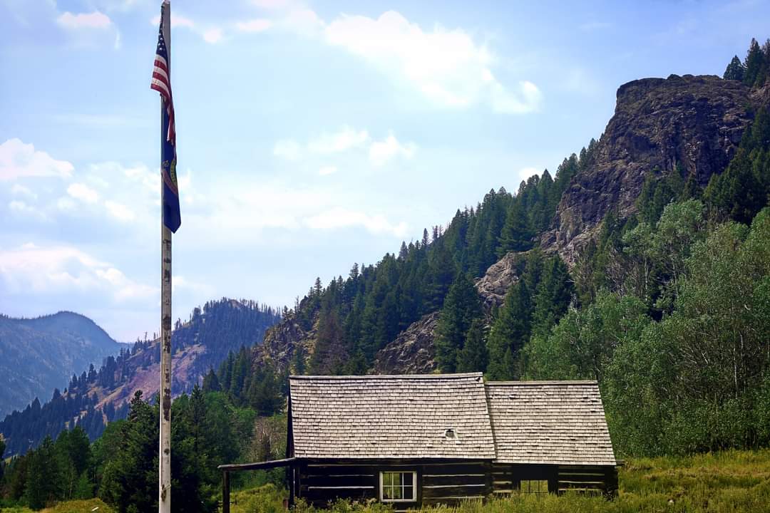
While walking, imagine the movement between those functions rather than inventing a scene inside an empty room. A settlement is a set of relationships: home to school, store to household, mine to mill. Even a few surviving buildings can make those relationships visible.
Why the boom ended
Custer’s fortunes depended on mining. When that activity weakened, the town’s shops and services lost their reason to operate at the same scale. By 1910, it had become a ghost town, according to the state tourism account.
That does not mean every object stayed exactly where its owner last used it. Buildings disappeared, materials were removed, and later decisions changed the townsite. Preservation histories are often less tidy than the phrase “untouched ghost town” implies.
The surviving district should be read as evidence of a community, not a complete stage set. Empty spaces matter because they show how much is missing.
Custer’s story also belongs beside neighboring Bonanza and the later industrial activity along the Yankee Fork. Different sites in the valley represent different mining methods and periods. Combining them gives a fuller picture than treating every ruin as part of the same boom.
How the surviving town gained protection
The Challis National Forest took ownership in 1966. Custer entered the National Register of Historic Places in 1981, and the Friends of Custer Museum helped keep the site available for public enjoyment. Visit Idaho’s preservation overview
The wider Land of the Yankee Fork State Park brings together interpretation of the region’s mining history. Its attractions include ghost towns, a museum and visitor center, and the Yankee Fork dredge.
The dredge is a separate attraction with its own operating arrangements. Its presence is a good reminder that mining did not end everywhere when Custer’s residential population fell away.
Do not assume that one ticket, one opening time, or one road condition applies to every stop in the region. Check the particular places you want to visit.
Making the most of a visit
Begin by checking current access and seasonal services with the Land of the Yankee Fork staff. The visitor center and the historic townsites are not a single compact complex, so allow time for travel between them.
Bring drinking water, food, sun protection, and a warm layer. A remote mountain outing is easier when you are prepared to spend longer on the road than expected.
At Custer, read the interpretation and enter only spaces open to visitors. Photograph the surviving buildings from ordinary visitor routes. Avoid climbing old equipment or taking loose material as a souvenir.
An effective visit can be simple: follow the street, spend time with the schoolhouse, and compare the remaining structures with the fuller town described in historical records. Ask what kind of life a family could build here, and what happened when the work supporting it disappeared.
The quiet becomes more meaningful when it is connected to those practical questions. Custer’s history is the story of a community whose ambitions were larger than the buildings that survived.
Frequently asked questions
Where is Custer ghost town?
It is in Idaho’s Yankee Fork region, near Bonanza and northeast of Stanley. It is unrelated to Custer State Park in South Dakota.
Why did Custer become a ghost town?
The settlement depended on nearby mines. Their decline reduced work and trade, and Custer had largely emptied by 1910.
Can visitors see historic buildings?
Yes. Surviving structures include the schoolhouse museum and Empire Saloon. Interior access and staffed interpretation depend on the season and current arrangements.
Is the Yankee Fork dredge inside Custer?
It is a separate nearby attraction. Check its hours independently when planning a combined visit.
Photo credits
Featured photo: shelleylyn from USA, CC BY-SA 2.0.

Body photo: Stevecvh, CC BY-SA 4.0.
