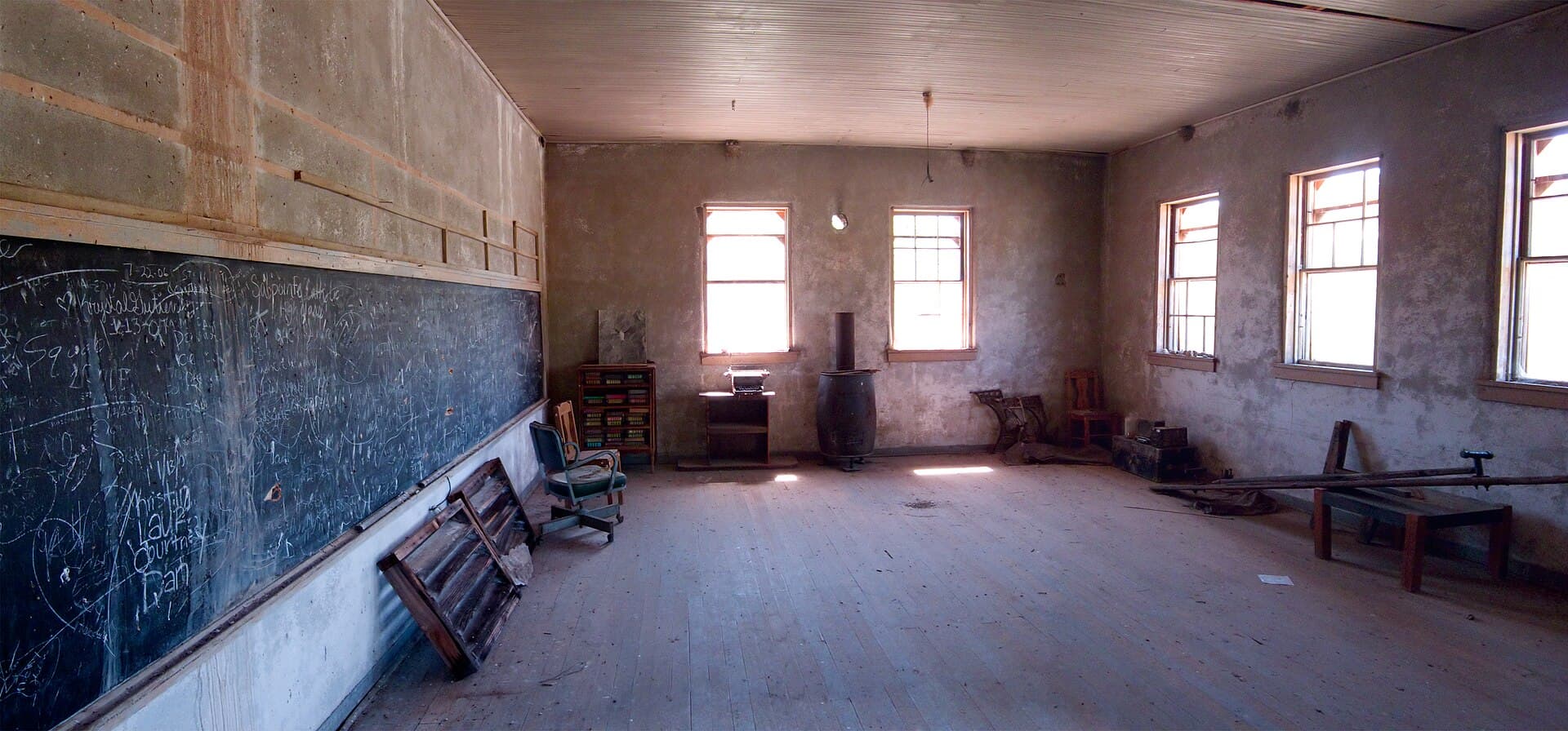
Ruby’s school and jail survive, but the gate to this Arizona mining town is closed to ordinary visitors.
Ruby ghost town is a privately owned former mining community in southern Arizona, near the Mexican border. It grew around the Montana Mine, which produced lead, zinc, and other metals before large-scale mining declined in the 1940s.
Public access ended in June 2024. That fact belongs at the beginning of its story today, because older guides still describe tours, fishing, camping, and visiting hours that no longer apply.
A mining camp beneath Montana Peak
Ruby’s earlier identity was Montana Camp. Its location reflected mineral deposits rather than convenience for travelers.
The Arizona Geological Survey’s study of zinc and lead deposits describes the Oro Blanco district and early claims around the Montana vein.
This landscape drew successive waves of prospecting and investment. Ruby was part of that wider district, not an isolated discovery with no connection to the surrounding hills.
Its name can be misleading. Ruby was not a town built around mining red gemstones. Its industrial importance came from metallic ore, especially the lead and zinc associated with the Montana operation.
The distinction helps place Ruby in a less familiar part of Western history. Precious-metal rushes get much of the attention, but communities also depended on metals used in everyday manufacturing and industry.
The Montana Mine made Ruby grow
The Arizona Historical Society’s Montana Mine collection preserves records of the operation and its later years.
Those records are an important counterweight to the ghost-town image. Behind a quiet collection of ruins was a business with reports, equipment, workers, and decisions about whether production could continue.
Eagle-Picher took over in the 1920s. Arizona Highways’ historical account describes this period as Ruby’s last major mining chapter.
The company’s investment expanded the operation. Housing and services followed the work, tying the settlement’s future closely to the mine.
That dependence made prosperity feel tangible, but fragile. A company town could offer employment and a place to live while leaving both vulnerable to the same closure.
The town behind the machinery
At its height, Ruby was home to roughly 1,200 people. Families lived alongside the industrial operation, and the surviving school makes that part of the story especially clear.
A classroom changes how a mining camp looks in the imagination. It suggests children growing up, lessons continuing, and parents making plans beyond the next ore shipment.
Photographs also show the small jail and other community structures. Each building had a role in keeping a remote settlement functioning.
The mercantile appears in accounts of violent crimes during the 1920s. Those events are documented history, but they should not be confused with a supernatural explanation for the town’s decline.
Ruby’s economic story is more direct. When the mining work ended, the reason for most residents to remain weakened with it.
Why Ruby became a ghost town
Arizona Highways’ overview of Arizona ghost towns places the exhaustion of profitable ore and the mine’s closure in 1940.
The Green Valley Recreation Hiking Club’s historical account describes the removal of the mill, the closure of the post office in 1941, and the school’s dwindling enrollment in the years that followed.
The archival chronology differs: the Arizona Historical Society records Eagle-Picher suspending operations in 1944 and later work continuing into the early 1950s. The clearest distinction is between the end of the boom and the end of all mining activity.
Ruby’s buildings did not all vanish together. Some structures were removed, while others remained and became the focus of later caretaking. What survives is a partial record of the larger community.
A second life as a place people could visit
Private owners bought the town in 1961. For decades, caretakers and visitors formed part of its later life.
An Arizona Highways feature describes the surviving adobe and cement buildings, lakes, and extensive mine tailings. Its editor’s note now clearly states that Ruby has been closed to the public since June 2024.
That later landscape matters as much as the boom years. A former industrial site can become a place of historical interest, wildlife habitat, family attachment, and difficult maintenance decisions.
Keeping an empty building standing still requires attention. Roofs, walls, weather, and wear do not stop being concerns when the last commercial operation closes.
The Arizona Daily Star’s closure report explains that the private owners ended public visits after more than three decades of welcoming tourists.
What the closure means for readers
Do not use old booking instructions or turn up expecting a caretaker to admit visitors. Ruby remains private property even though surrounding land includes national forest.
Historical photographs provide a way to study its layout without crossing a closed gate. Compare the school, jail, and town views with the mining records to see how industrial work shaped the settlement.
Ruby’s story is not finished simply because public visits ended. Preservation and ownership continue after tourism stops.
The place remains compelling because its surviving buildings make a vanished working community feel close. Respecting the closure is part of respecting the history still held there.
Frequently asked questions
Is Ruby ghost town open to the public?
No. Public visits ended in June 2024. Older tour, fishing, and camping information is outdated.
Why was Ruby abandoned?
The mining economy contracted in the 1940s, undermining employment and services. Sources differ on closure dates because later, smaller operations continued.
Is Ruby on public land?
The townsite is privately owned. Nearby national forest does not make the town itself open to entry.
What remains at Ruby?
Historical photographs and reporting document the school, jail, homes, industrial remains, lakes, and tailings. They do not establish current public access.
Featured photograph: Alan Stark. Original image and details. CC BY-SA 2.0. Photograph predates this article; it is not a real-time view.
