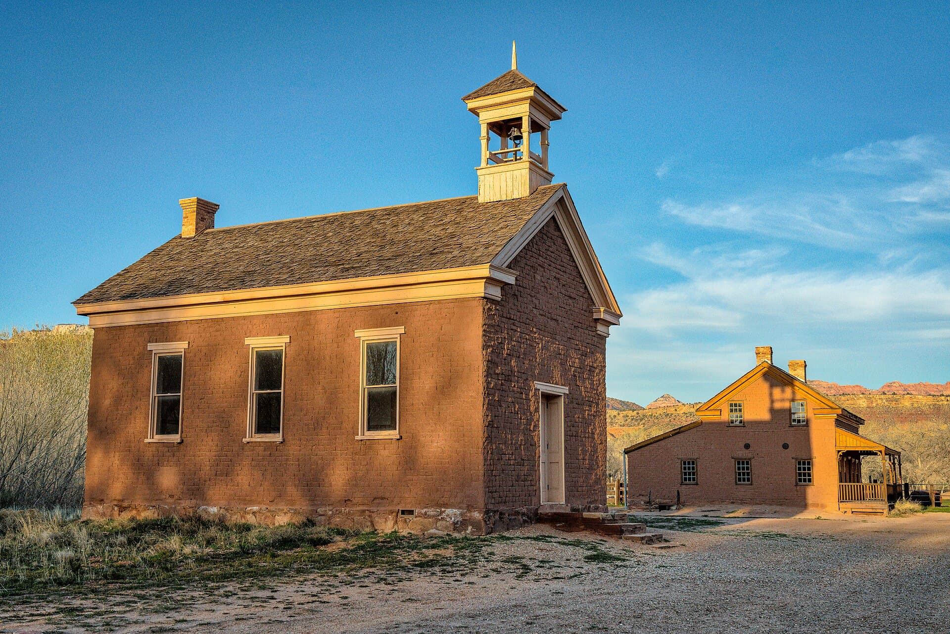
Grafton’s adobe schoolhouse stands beneath red cliffs, but the river explains why its classrooms fell silent.
Grafton ghost town near Rockville, Utah, is a preserved farming settlement south of Zion National Park. Founded in 1859, it struggled with floods, limited farmland, and the difficulty of sustaining a community along the Virgin River. Its schoolhouse, homes, and cemetery can be visited today, with important limits on services and wet-weather access. Grafton Heritage Partnership history
Unlike many western ghost towns, Grafton did not depend on a mineral strike. The challenge was more basic: keeping enough usable land and reliable water to support families.
Why Grafton ghost town began beside the river
Five families established the settlement in 1859, growing cotton and food crops with irrigation. The river offered the water they needed, but its floodplain created a persistent risk. Visit Utah’s Grafton guide
This was part of a wider pattern of settlement along the upper Virgin River. The National Park Service describes communities struggling with limited arable ground, difficult soils, and destructive flooding. Some places endured; others were abandoned for more favorable locations. Zion National Park’s settlement history
The valley was also home to Southern Paiute people before the newcomers arrived. Grafton’s history belongs within that older, continuing human landscape, including the competition for land and resources that settlement brought.
A town rebuilt after disaster
A major flood in January 1862 destroyed the original Grafton. Settlers rebuilt about a mile upstream, at the site visitors know today.
The move reduced one immediate problem without eliminating the river’s power. Irrigation works required repeated repair, and usable farmland remained limited. The community also temporarily emptied during regional conflict in the 1860s before families returned. Grafton Heritage Partnership’s settlement chronology
These repeated decisions matter more than a simple abandonment date. Families tried to make the town work, adjusted to setbacks, and eventually faced choices about where their children could build lives.
The Utah State Historical Society’s photograph collection places Grafton’s decline in that broader search for better opportunities and access. Its surviving images document a settlement whose landscape and buildings continued to change. Utah State Historical Society collection guide
The schoolhouse gives the story a center
Grafton’s schoolhouse is the most recognizable building at the townsite. Its adobe walls and belfry make a compact landmark against the cliffs.
The building served as a school and meeting place. Washington County’s historical society records the purchase of a bell around 1891, a small detail that suggests how the community marked its shared routines. Grafton school-bell history
The bell recalls everyday routines: classes, meetings, and the moments when neighbors gathered.
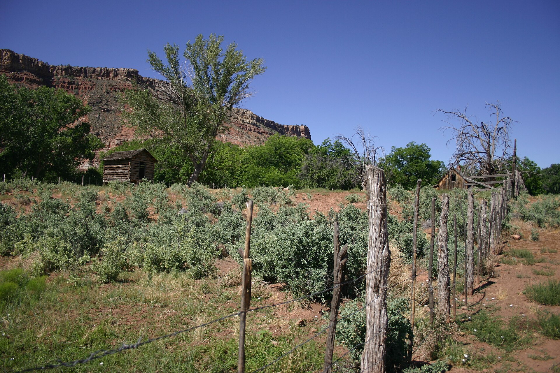
Nearby homes and outbuildings add the domestic scale. Look at their relationship to the open land rather than treating each as an isolated photographic subject. Grafton was a farming community, and the spaces around the houses were part of its working life.
Why families finally left
Flood damage was only part of the problem. There was little room for the next generation to establish farms, and other places offered better prospects.
James T. Jones’s history of Grafton identifies the Hurricane Canal as an important turning point. The canal opened agricultural opportunities downstream, and many residents moved away. Old Grafton historical account
Grafton dwindled through the early twentieth century and was effectively deserted by the mid-1940s. Sources differ on the exact final departure year, so the broader period is more useful than pretending the entire town closed on a single agreed date.
Later, filmmakers found another use for its setting. Scenes for the 1969 film Butch Cassidy and the Sundance Kid were filmed at Grafton. That is a documented screen connection, not evidence that the real outlaws made the town their home. Washington County Historical Society
What preservation has saved
The Grafton Heritage Partnership has purchased land, restored the schoolhouse, rehabilitated the Russell home’s exterior, and obtained conservation easements. Its work protects both buildings and parts of the surrounding landscape. Partnership preservation accomplishments
That landscape protection is especially meaningful here. A schoolhouse separated from every field and historic view would tell a thinner story.
Visitors can help by keeping the place undisturbed. Respect fences, stay out of closed structures, and treat the cemetery as a burial ground rather than a prop for ghost stories. Paranormal claims remain folklore, not established explanations for the town’s decline.
Planning your visit
Use the partnership’s directions from Rockville via Bridge Road and follow signs toward the townsite. The organization warns that the road can become impassable in heavy rain.
There are no toilets, drinking water, or other services at the townsite. Prepare in Rockville or another nearby community, carry water, and avoid making the trip during conditions that could trap a vehicle on wet roads.
Grafton is outside Zion National Park. Treat it as a separate visit with its own access conditions.
Allow time for the schoolhouse, the homes, and the cemetery. The lasting impression is a community that kept trying to remain beside a difficult river, and the quieter work of people who now keep its memory visible.
Frequently asked questions
Is Grafton inside Zion National Park?
No. It is near Rockville, south of the park, and requires a separate approach.
Why was Grafton abandoned?
Flooding, limited farmland, difficult irrigation, and better opportunities elsewhere gradually drew families away.
Can you drive to Grafton?
The road is used for scenic driving, but heavy rain can make it impassable. Check conditions and follow posted directions.
Are there bathrooms or water?
No. The preservation organization lists no toilets or drinking water at the townsite. Bring supplies and use facilities before arriving.
Photo credits
Featured photo: Mobilus In Mobili, CC BY-SA 2.0.

Body photo: Jeff Turner from Santa Clarita, CA, United States, CC BY 2.0.
