Is This Truly The End Of The World? The Coastal Steep Slope That Broke Australia And Antarctica Apart!
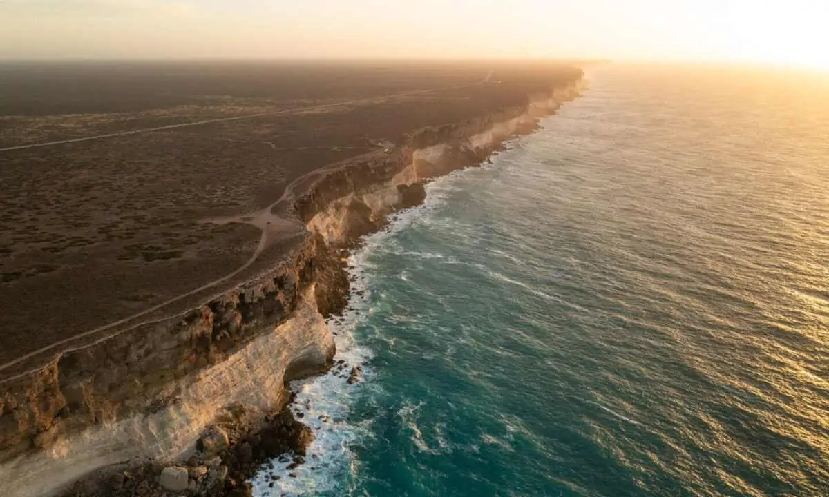
Imagine standing on the edge of a vast, flat landscape, only to suddenly find yourself at the top of towering cliffs. The cliffs plunge straight down into the ocean. This is the Bunda Cliffs, a geological wonder located on the southern edge of the Nullarbor Plain in South Australia. The steep slope of the cliffs is known as the “edge of the world.” These dramatic cliffs drop into the Great Australian Bight. When you look from there all you see is the southern ocean and nothing else.
The cliffs are made up of layers of limestone, that formed over millions of years. It dates back to when Australia began separating from Antarctica around 65 million years ago. This process helped shape the landscape and left behind the stunning cliffs we see today. Even today, the cliff edge is constantly collapsing. Many tourists around the year make visits to see its beauty. Let’s have a closer look at the Bunda Cliffs and its reputation as the end of the world.
Breathtaking Bunda Cliffs – Australia’s Edge of the World
The Bunda Cliffs truly live up to their nickname, marking the end of the continent. These massive cliffs stretch along 200 km of coastline. It forms a natural wall where the Nullarbor Plain abruptly ends and the Southern Ocean begins. When you stand at the top of the cliffs, you can see nothing but the endless ocean on one side. On the other side is the flat, barren Nullarbor Plain.
These cliffs are a visible remnant of when Australia separated from Antarctica as part of a larger tectonic shift. The separation occurred 65 million years ago. It left behind layers of limestone that tell the story of an ancient seabed.
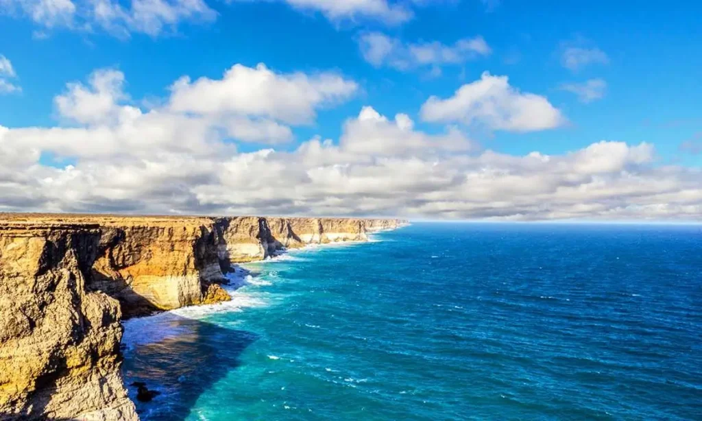
At the base of the Bunda Cliffs, you’ll notice a white band of rock. It is known as the ‘Wilson Bluff Limestone.’ The chalky layer is part of an ancient seabed that formed when Australia began separating from Antarctica. The Wilson Bluff Limestone is roughly 300 meters thick. But only the upper portion is visible at the cliffs. The layers of limestone are filled with fossils of marine life, such as worms and mollusks. It shows how the area was underwater in the past. The Bunda Cliffs is a place where you can see both the end of Australia and the beginning of the Southern Ocean.
The best way to appreciate the scale of the Bunda Cliffs is from the air. Helicopter tours offer visitors a bird’s-eye view of the cliffs, allowing them to fully grasp the size and grandeur of this natural wonder. Virtual tours are also available for those who can’t visit in person, providing a glimpse of this unique landscape.
@daninatalie Replying to @ayowhatthehell the edge of the world! #southaustralia #greataustralianbight ♬ Home Resonance – Stay a while
The Vast Nullarbor Plain
Behind the Bunda Cliffs lies the Nullarbor Plain, the world’s largest single piece of limestone. This flat, treeless landscape stretches for about 1,000 km from east to west and covers 270,000 square kilometers. The name “Nullarbor” comes from the Latin for “no trees,” which is a fitting description of this barren, featureless plain.
The plain is entirely flat. The Trans-Australian Railway runs for 483 km in a perfectly straight line across its surface. However, it has some interesting features, such as slight depressions where rainwater has slowly dissolved the limestone. There are also sinkholes and caves, formed when underground caves collapse. But overall, the Nullarbor is a vast, treeless desert that ends dramatically at the Bunda Cliffs.

The Nullarbor Plain and the Eyre Highway
The Nullarbor Plain is more than just flat land; it also holds historical significance. The Eyre Highway, which runs near the cliffs, is Australia’s main east-west link, following the coastline less than a kilometer inland. The highway is named after Edward John Eyre, who attempted to cross the Nullarbor Plain in 1841. Eyre’s journey was fraught with challenges, including a mutiny that led to the death of his companion, John Baxter. Despite these hardships, Eyre completed the journey with the help of an Aboriginal guide named Wylie.
Today, travelers along the Eyre Highway can stop at one of five main lookouts to view the cliffs. The most popular lookout is at the western end, where a rock juts out from the cliff, offering a stunning view of the coast. Visitors can also visit the eastern end of the cliffs at the Head of the Bight, a famous spot for whale watching.
@daninatalie Moments like this, with you. #travel #australia #greataustralianbight ♬ original sound – Nathan
Southern Right Whales at Head of the Bight
The Head of the Bight is not just known for its cliffs—it’s also one of the best places in Australia to watch southern right whales. These massive creatures migrate from sub-Antarctic waters to give birth along the southern coast of Australia. Between May and October, visitors to the Head of the Bight can watch whales swim and play in the waters below the cliffs, an unforgettable experience.
Conclusion
The Bunda Cliffs are more than just a dramatic geological feature—they are a place where history, nature, and mystery come together. These cliffs represent both an end and a beginning: the end of the Australian continent and the beginning of the Southern Ocean. They remind us of Australia’s ancient past, the slow-moving forces that have shaped the land, and the importance of protecting natural wonders like these for future generations.
Also read,