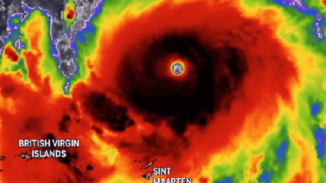
A stronger and larger Hurricane Erin is fueling concern along the U.S. East Coast after reaching Category 4 strength late Sunday. With maximum sustained winds of 130 mph, the storm is creating life-threatening surf and rip currents even though it is not expected to make a direct landfall.
Storm Path and Intensification
The National Hurricane Center in Miami reported that Erin’s outer bands pelted Puerto Rico and the Virgin Islands on Sunday with heavy rain and tropical-storm-force winds. Erin was located about 130 miles east-northeast of Grand Turk Island and nearly 965 miles south-southeast of Cape Hatteras, North Carolina. The hurricane is moving northwest at 12 mph.
Forecasters expect additional strengthening Monday, followed by gradual weakening later in the week. Despite the weakening trend, Erin is predicted to remain a large, major hurricane into midweek, with its area of strong winds expanding even further.
Impacts on the Caribbean and U.S. East Coast
In Puerto Rico, the storm knocked out power to about 147,000 customers, according to Luma Energy. More than 20 flights were canceled due to weather conditions. Ports in Puerto Rico and the U.S. Virgin Islands were reopened by the U.S. Coast Guard after winds subsided Sunday afternoon.
Dangerous surf conditions are forecast to continue across the Virgin Islands, Puerto Rico, Hispaniola, and the Turks and Caicos in the coming days. By midweek, life-threatening surf and rip currents are expected to reach the Bahamas, Bermuda, the U.S. East Coast, and even Atlantic Canada.
Emergency Declarations in North Carolina
Dare County, North Carolina, declared a state of emergency and ordered evacuations for Hatteras Island beginning Monday. Officials warned that high surf and waves could wash out parts of N.C. Highway 12, the primary road connecting communities along the Outer Banks. The National Weather Service has urged residents and visitors to take the evacuation order seriously.
A Storm Fueled by Climate Change?
Scientists warn that climate change is making hurricanes like Erin more dangerous. Warmer ocean waters provide more energy for storms to intensify rapidly, while a hotter atmosphere holds more water vapor, increasing rainfall potential. Erin briefly reached Category 5 strength Saturday with winds of 160 mph before weakening back to Category 4.
“You’re dealing with a major hurricane. The intensity is fluctuating. It’s a dangerous hurricane in any event,” said Richard Pasch of the National Hurricane Center.
Looking Ahead
While Erin is not forecast to directly strike the U.S. mainland, its growing size ensures that coastal communities from the Carolinas to New England will face days of dangerous surf, rip currents, and beach erosion. Officials continue to monitor the storm’s path closely, urging residents to remain alert and prepared for changing conditions.