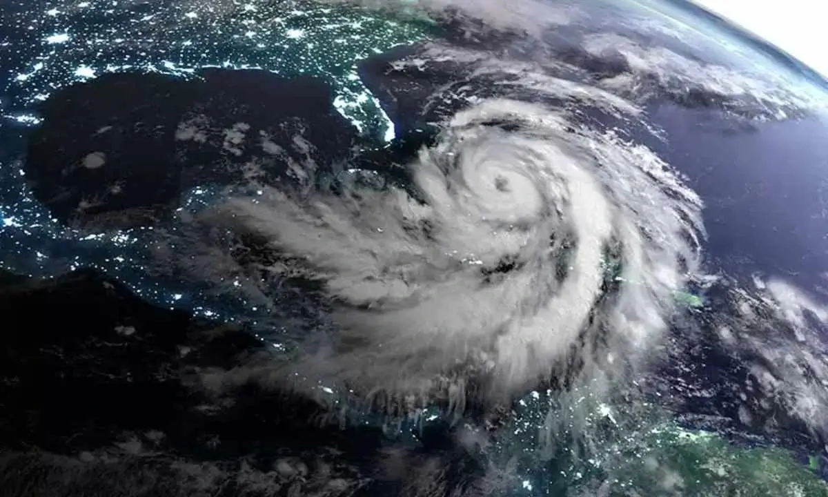
Hurricane Milton is quickly shaping up to be one of the most dangerous storms in recent history. It jumped from a Category 4 hurricane to a powerful Category 5 in just a few hours. With sustained winds reaching 180 mph, it’s now aiming directly at Florida’s Gulf Coast. This is when Florida still recovering from Hurricane Helene’s destruction just a week ago.
This storm could be the worst to hit the Tampa Bay area in over a century. Historically, only 40 hurricanes have ever reached Category 5 in the Atlantic. Milton is part of a rare group of seven hurricanes that intensified from Category 1 to Category 5 within 24 hours. The rapid growth of Milton puts makes it the third highest on record in the Atlantic’s record books after Hurricanes Wilma in 2005 and Felix in 2007. Let’s have a closer look at the details.
“Milton has the potential to be one of the most destructive hurricanes on record for west-central Florida.”
According to the National Hurricane Center.
Massive Evacuations Ordered and Public Warnings
Florida officials are wasting no time in preparing for Milton. Mandatory evacuations are issued for counties along the West Coast, including Charlotte, Hillsborough, Pasco, and Pinellas. Millions of people from the above areas are given the warning to leave.
“I beg you. I implore you. Drowning deaths due to storm surge are 100% preventable if you leave.”
Kevin Guthrie, Florida’s director of emergency management.
Florida’s Governor Ron DeSantis has declared a state of emergency in 51 counties, and President Biden has authorized federal assistance to support the state’s efforts.
“You don’t have to evacuate hundreds of miles. If you’re in areas susceptible to storm surge, go to areas that are not.”
DeSantis reassured residents they don’t need to go far to be safe.
He suggested shelters, hotels, or staying with friends or family on higher ground.
4pm CDT Oct 6th Key Messages for #Hurricane #Milton:
— National Hurricane Center (@NHC_Atlantic) October 6, 2024
Forecast to be a major hurricane when it reaches W coast of #Florida Peninsula this week. Too soon to specify magnitude & locations of greatest impacts, but risk of life-threatening storm surge & damaging winds increasing.… pic.twitter.com/clGNT0ff6Y
Hurricane Milton’s Current Path and Potential Impact
As of Monday evening, Hurricane Milton is about 675 miles southwest of Tampa, moving east-southeast at 10 mph. The storm expects to make landfall near the Tampa Bay area by Wednesday evening. It will bring catastrophic winds, heavy rain, and dangerous storm surges with it.
Rainfall could reach 5 to 10 inches across parts of Florida, with localized areas seeing up to 15 inches. These conditions will lead to flash flooding, especially in urban areas. The Florida Keys and northern Yucatán Peninsula will also experience heavy rainfall and flooding.
The National Hurricane Center has warned of “life-threatening storm surge and damaging winds” for the Florida coast.
Milton is compared with past storms like Hurricane Michael in 2018. These hurricanes caused widespread destruction. Unfortunately, Milton is shaping up to be just as dangerous, if not more so.

Warnings and Preparedness
Currently, several warnings and watches are in effect across Florida and parts of Mexico:
- Hurricane Warnings: These are in effect for Mexico’s coastline from Celestún to Rio Lagartos and Florida’s west coast, from Bonita Beach to Suwannee River, including Tampa Bay. This means hurricane conditions are expected soon.
- Hurricane Watches: In effect for parts of Florida’s west and east coasts, including the Dry Tortugas and Lake Okeechobee, meaning hurricane conditions are possible within the next 48 hours.
- Tropical Storm Warnings: Cover areas from Rio Lagartos to Cancún and parts of the Florida Keys. These areas can expect tropical storm conditions within 36 hours.
- Storm Surge Warnings: This includes the Florida coastline from Flamingo to Suwannee River, with the potential for deadly flooding along the Tampa Bay area and Charlotte Harbor.
- Mandatory evacuations – Includes Charlotte County (along the Gulf, Charlotte Harbor, and the Myakka and Peace rivers), Hillsborough County, Pasco County, Pinellas County, and its residential healthcare facilities.
Residents are strongly urged to secure their property, stock up on essential supplies, and follow local evacuation orders. FEMA has stressed the importance of preparing for the worst. Authorities encourage people to listen to local officials.
Hurricane Milton Amid An Active Hurricane Season
This has been a particularly active hurricane season. Milton was the 13th named storm of 2024. According to NOAA, a typical Atlantic hurricane season sees 14 named storms, but it’s only early October, and the season is already running ahead of schedule.
Climate change is believed to be a contributing factor to the rapid intensification of storms. Warmer sea temperatures are leading to more powerful and faster-growing hurricanes. Scientific studies, including research from NOAA, suggest that as the climate continues to change, hurricanes will likely become more intense and frequent.
Federal resources are also stretched thin as FEMA continues recovery efforts from Hurricane Helene. But they are still preparing for Milton’s impact. President Biden has hinted that Congress may need to pass an additional spending bill to provide financial support for the ongoing recovery efforts in affected areas.
7pm CDT Oct 7th — #Hurricane #Milton remains an extremely dangerous Category 5 hurricane with winds of 180 mph.
— National Hurricane Center (@NHC_Atlantic) October 8, 2024
The minimum center pressure measured by a @NOAA_HurrHunter dropsonde was estimated at 897 mb.
Latest: https://t.co/LQEVorqXZH pic.twitter.com/xT7o6vHF7r
Conclusion
Hurricane Milton’s destructive path is a reminder of the power and unpredictability of nature. For those in its path, preparation is key. Following evacuation orders, securing property, and staying informed can make the difference between life and death. As Milton closes in on Florida, it’s vital for residents to stay tuned to local advisories and take every precaution possible. This hurricane season is far from over, and the challenges it presents continue to grow.
Also read,


